Humla is the most remote district in Nepal, and one of the poorest. It's also the most sparsely populated part of the country. The combination of state neglect and bad press (when did you last read something good about Humla?) means there are few tourists, and you'll meet most of them in or headed to the border town of Hilsa, a stepping stone to Mount Kailash in Tibet. All the better for you to enjoy the wonders of Humla at your leisure. You won't regret it; locals will appreciate the fact that you have sidestepped the more obvious destinations in the Everest and Annapurna regions. There are not many jobs going in Humla, and your visit could well make the difference between a family migrating to India or the Gulf and their setting up a profitable teahouse on the trail.
The trek
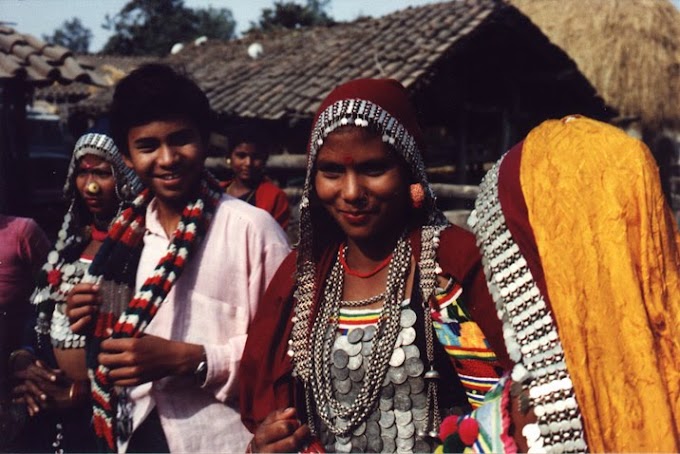
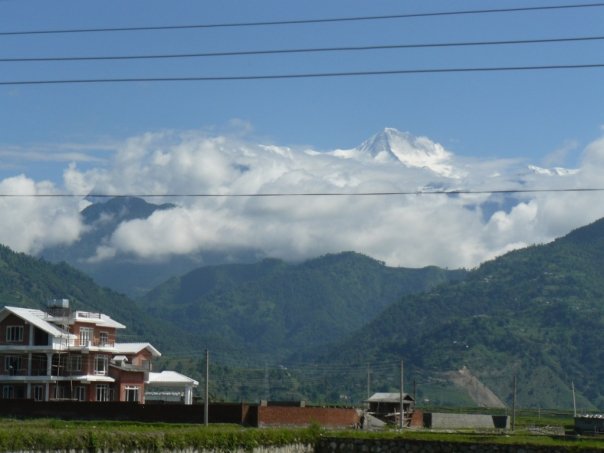
Humla is a land of extremes. Simikot, spread out on a flattened hilltop amidst a colourful harvest expanse of fields, lies at 2900m. From here the newly designatedGreat Himalaya Trail follows the old salt trading route to Tibet between the towering green monoliths of the sisnoo-infested Hindu midlands up to the arid expanses of our version of the Tibetan plateau, all the while accompanied by the roaring quicksilver of the magnificent Karnali. You'll pass occasional tight clusters of mud-packed, flat-roofed houses where women with heavy gold & silver jewellery embroidered with colourful beads belie the obvious, all-pervading poverty. Thakuri men lead flocks of long-haired, impressively horned goats up and down the muddy trail on their way to and from Tibet.
As you approach Hilsa and the northwestern border, the landscape becomes drier, and the context, Buddhist. Look out for the contrasting monasteries at Yalbang and Tumkot. After the desolate Tibetesque views around Hilsa, the Limi Valley, approached through amazing red rock scapes haunted by blue sheep and huge vultures, is as isolated as anything you will see in Nepal. There are three medieval stone villages here, a day apart, with a must-see monastery at Halji. You'll then walk through a dessicated high-altitude landscape (and through the bone-numbing cold of the Ling Chu River) to nestle in the glacial valley below the Nyalu Pass. The aquamarine Tshom Tsho lake on the way is all the more remarkable for the contrast with the burnt sienna of the treeless expanses. A tough climb to 5000m, then back down into an astonishingly verdant birch and pine forest chittering with birds and a campsite in the shadow of a massive rock face.
How to get there
Take a bus or plane to Nepalganj, then a plane to Simikot, district headquarters of Humla. Apparently you have a better chance of getting a flight to Simikot if you travel from Nepalganj to Birendranagar, Surkhet (through Bardia National Park). Once you overcome the logistical and weather-related problems that may occur if you are travelling at the end of monsoon, just start walking. If you do get stuck waiting for a flight, you can explore Bardia National Park from either Nepalganj or Birendranagar, but I'd recommend the latter for little visited sights such as Kakrebihar, where the mossy ruins of a medieval temple in the midst of a forest make for an unexpected, atmospheric day trip.
Itinerary
Your 12-day trek beings at Simikot, from where you head northwest along the Karnali River. We stopped for the night at Dharapuri, Kermi, Yalbang, Tumkot and Hilsa, but the location of teahouses or the preferences of your camping group may vary. From Hilsa, cut back through the Limi Valley, stopping at campsites at Manepeme, Til, Tatopani (non-negotiable, as it really does have a hot spring you'll appreciate at the end of a dusty day's walk) and Talung. Over and up the 5000m Nyalu Pass and down into the birch and pine forests to a campsite alongside the Sallu River, then back to the trail to Simikot, stopping only at Dhandkermi, and you have a perfect circuit in less than a fortnight.
What to take
 The usual trekking gear (good boots!), and don't forget to keep warm. Nights at 4000 metres can be freezing cold (but brave the winds to step out of your tent forsuperlative views of an exploding Milky Way). The usual way to do it is to log onto a camping expedition, but it is possible, with some prior research, to find lodging at some of the new teahouses along the route. Take a sleeping bag and if you want to go solo in the Limi Valley, you'll need a tent and extra food, as very little will be on sale here, and not everyone speaks Nepali, either. Take extra batteries for your camera, as it's sometimes hard to get a recharge along the way.
Room and board
If travelling with a camping group (Janga Bahadur Lama of Firante Travels, www.firante.com, organises such groups), you'll get a composite price, including flights to Nepalganj and Simikot. If going solo, keep in mind that while food is much more basic than on the Annapurna and Everest trails, and thus cheaper, accommodation in teahouses is both more basic and more expensive. Expect to spend about Rs 200 per dalbhat and up to Rs 500 for a bed. If you want something in between dalbhat (teahouse standard) and pasta (camping special), try the local cuisine, including tsampa (roasted barley flour that is great as porridge), nettle soup, thukpa, buckwheat pancakes, and Humli apples. You won't get to pick out your 'local chicken' here, but might come across jaw-numbing yak sukuti or pungent chyangra. You may want to wait till you approach the Tibetan border before you go wild on the Lhasa beer (though the altitude deserves respect), which gets cheaper as you go along. Personal recommendation: barley (uwo) chyaang for a donkey kick better than what you get out of its Kathmandu counterpart


