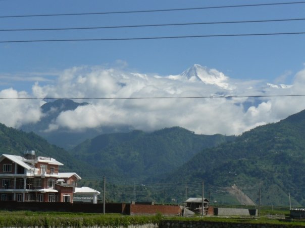
Mount Makalu (8463m.) was first climbed by a French party in 1955. The peak was first mapped and photographed from the Tibetan side by the 1921 British Everest reconnaissance. Hillary and Shiptonphotographed mount Makalu during a side trip on the 1951 Everest reconnaissance. Hillary and others approached the peak a year later after the failure of their mount Cho Oyu expedition.
The first attempt on mount Makalu was in 1954 by a US team, mostly from California , who trekked all the way from the Indian border near Biratnagar. At the same time a British team approached the mountain, but this expedition was abandoned when Hillary became seriously ill and had to be evacuated.
In the autumn of 1954 a French team attempted the peak. In the following spring, successfully ascents were made by three teams of French climbers on successive days.
In 1960 a large scientific and mountaineering expedition wintered at the foot of mount Ama Dablam, occupying the Green and Silver buts. In May 1961, the expedition trekked across the Mingbo La and other high passes to the foot off mount Makalu , where they planned to climb the French route, Sickness stopped the expedition, which became a heroic struggle for survival.
The Japanese climbed mount Makalu in 1970, another French team climbed it in 1971 and a Yugoslav expedition reached the summit in 1975. In 1976 Spanish and Czechoslovakian teams joined up near the summit.

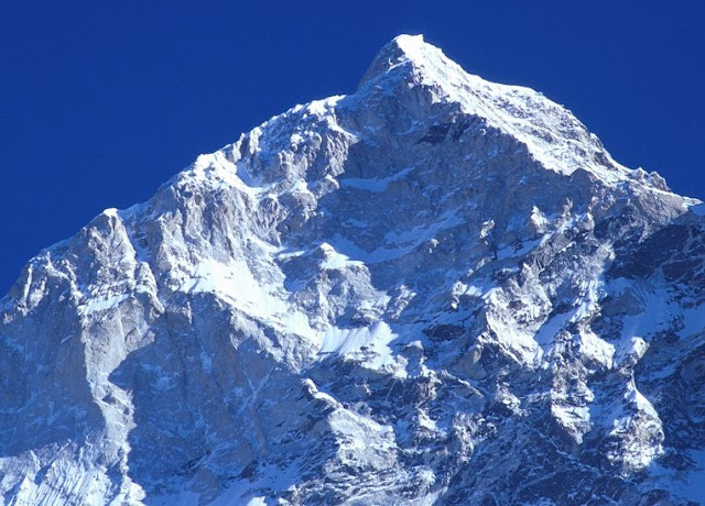
Makalu West Face
It is very adventurous route to climb because it is a little bit dangerous as well. The 5 attempts were made before climbing this Mount Makalu Mountain ; then only it was succeeded in the final.
The West Face was successfully summit in 1997. The Russian expedition had taken the route of this West Face of mount Makalu, leaded by Sergey Efimov and climbed the top on 21st of May via the most difficult route. The last part of the route had gone on Parago ridge. Alexei Bolotov, Yuri Ermachek, Dmitri Pavlenko, Igor Bugachevski and Nikolai Jiline had climbed on the top of mount Makalu at this time For this ascent they were awarded the "Gold ice-axe".
The routes are of 4 parts:

The bottom part starts from the base of the West Face at 5,800 meters and climbs to the hanging ice-fall at 6,100 meters to the right part of the ice-fall. The second part extends from the plateau above the ice-fall along 35 to 45 degree elevation's rock up to the 6,500 meters high. The next section is an ice-rock wall, 50 to 55 degrees steep and that extends to 7,400 meters height. The last final section begins 70 to 75 degree elevation's rock pillar, which leads to the west ridge at 8,000 meters height till to the top of the summit.
Ropes are typically fixed from 5800m to 6100m and from 6500 m to 7500m. Camps established by the Russian Team were at the following locations.
The French Route on the West Pillar is an aesthetically stunning line that has been seldom attempted. It is an exceedingly difficult, a very steep pillar that was first successfully ascended in 1971. The crux of the line comes at approximately 7,600m in the area of the Seignior Wall.
The first US team to summit was in 1980, they summit via this West Pillar Route . The team was made up ofJim States , John Roskelley, Kim Momb and Chris Kopczynski. They summit 2 members of the team and put 2 members within 150 feet. They summit without the use of oxygen or Sherpa support.
Itinerary

Fly to Tumlingtar
Tumlingtar - Kuwapani
Kuwapani - Chichila
Chichila - Num
Num- Seduwa
Seduwa - Tashigaun
Tashigaun - Khongma La (Danda)
Khongmadanda - Mumfuk
Mumfuk -Yangle Kharak
Yangle Khark -Merak
Merak -Sersung (half day rest) for acclimatize
Sersung - Makalu Base camp
Climbing Period for Makalu 8463m.
Makalu BC - Mumbuck
Mumbuck - Khongma La (Danda)
Khongma La - Seduwa
Seduwa - Chichila
Chichila - Tumlingtar
Tumlingtar - you can take the flight from here